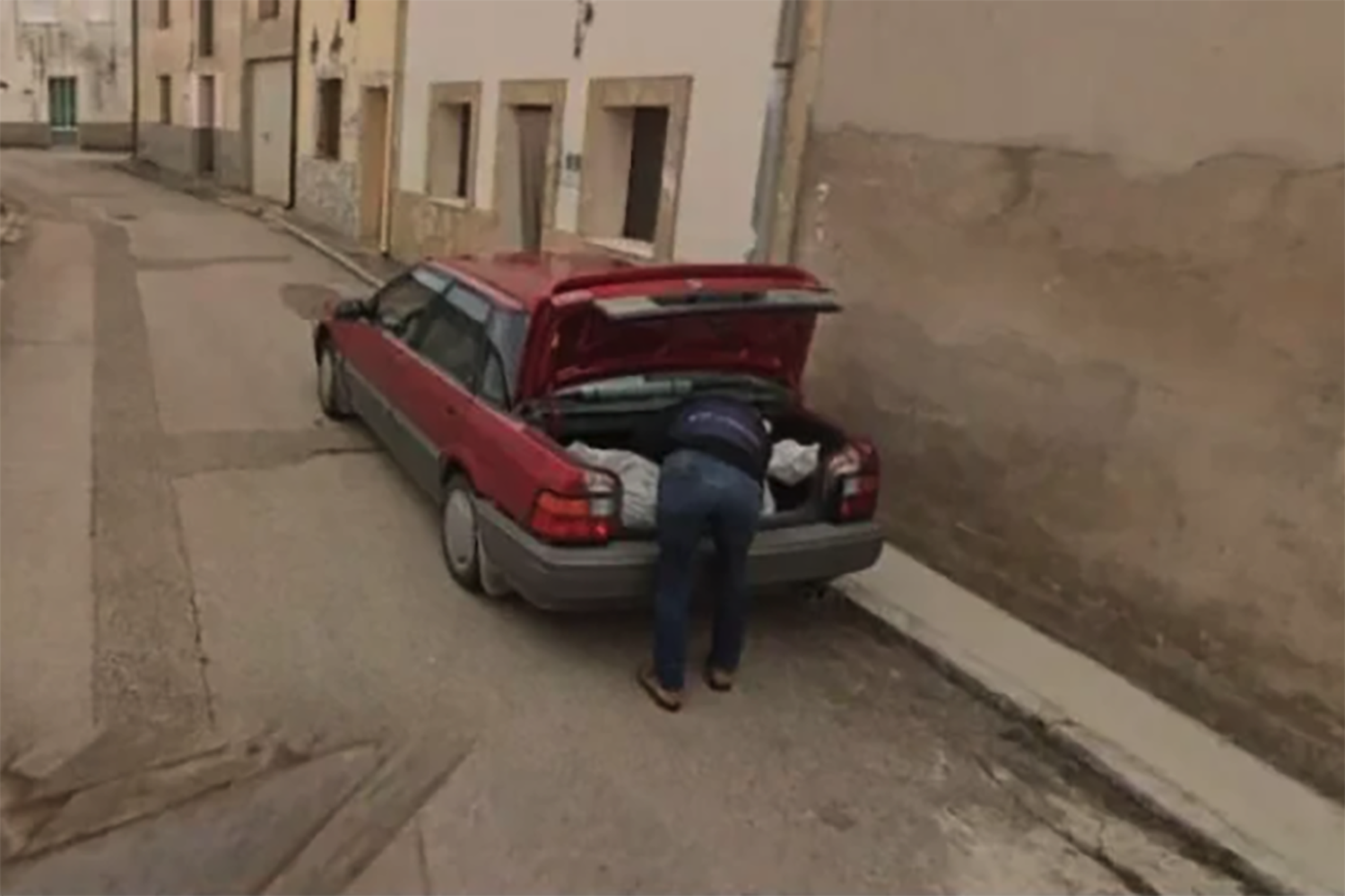
In the course of its globe-mapping mission, a Google Street View car appears to have documented the very moment that crime suspects deposited what sure looks a whole helluva lot like a wrapped-up corpse in the back of a car.
That supposed corpse is believed to be a Cuban man whose relative reported him missing last year. The man had traveled to Spain and was living in the remote municipality of Soria at the time of his disappearance, reportedly in the hopes of finding a woman that he believed to be his romantic partner. The relative received suspicious texts from the man’s phone that convinced him something was wrong. This year, part of the man’s dismembered body was found buried in a cemetery in the local hamlet of Tajueco, confirming that he had been murdered.
In a statement now released by police (that has been translated from Spanish to English via, again, Google), investigators said that two people had now been arrested in connection with the man’s disappearance. Curiously, a key bit of evidence that had helped the police lock onto the suspects were “images in a location application” that appeared to have “detected a vehicle that may have been used during the course of the crime,” the statement says. That application, apparently, was Google Maps.
Indeed, a Google Street View car just happened to be passing by a street in Tajueco when one of the suspects in the case was packing…something…into the back of a red car. BBC reports that this was the first time in 15 years that Google had traveled to the tiny Spanish town, a community of some 56 people.
Google Street View image helps police unlock murder case https://t.co/swr2OSZXfF
— BBC News (World) (@BBCWorld) December 18, 2024
The two people who were arrested were identified as “a woman, a partner of the disappeared, and a man, who had been a partner in the detainee.” Police described the couple as “alleged perpetrators of a crime of aggravated illegal detention for not to give a reason for the whereabouts of the disappeared person.”
It should be noted that while the picture circulating online sure looks like somebody packing a dead body into the back of a vehicle, the accused have not been convicted yet and they are only alleged to have committed crimes.
This would not be the first time that Google Maps has played a pivotal role in a police investigation. In 2019, a 22-year-old cold case was solved after Google Earth images revealed the location of a submerged car in a pond in Florida. So, I guess the surveillance industrial complex has its upsides.
Trending Products


